Gary Park
-
Posts
4 -
Joined
-
Last visited
-
Symptoms - You're a STAR🌟 That's fantastic - just what I was after. I would assume that someone made arrangements with the NCB so they left this building but demolished everything else - probably the company you're referring to. You can just imagine a use like that for a former colliery site and building. Hope your brother was never affected by the asbestos exposure ! Once again Many Thanks. Gary
-
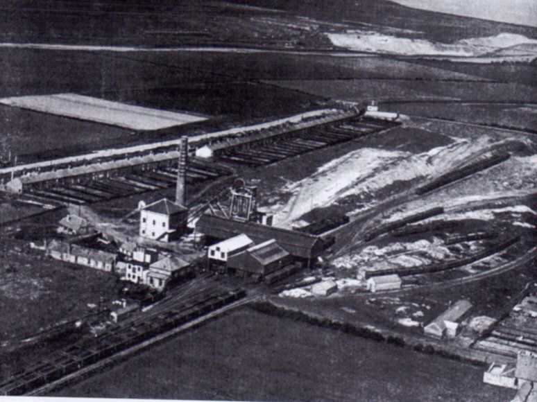
Hi Alan, Thanks for all that but the point of my interest in the site is purely what the building which remained onsite after the colliery closure was used for - POST CLOSURE. I don't know where I found the aerial photo but its attached below. Regards Gary
-
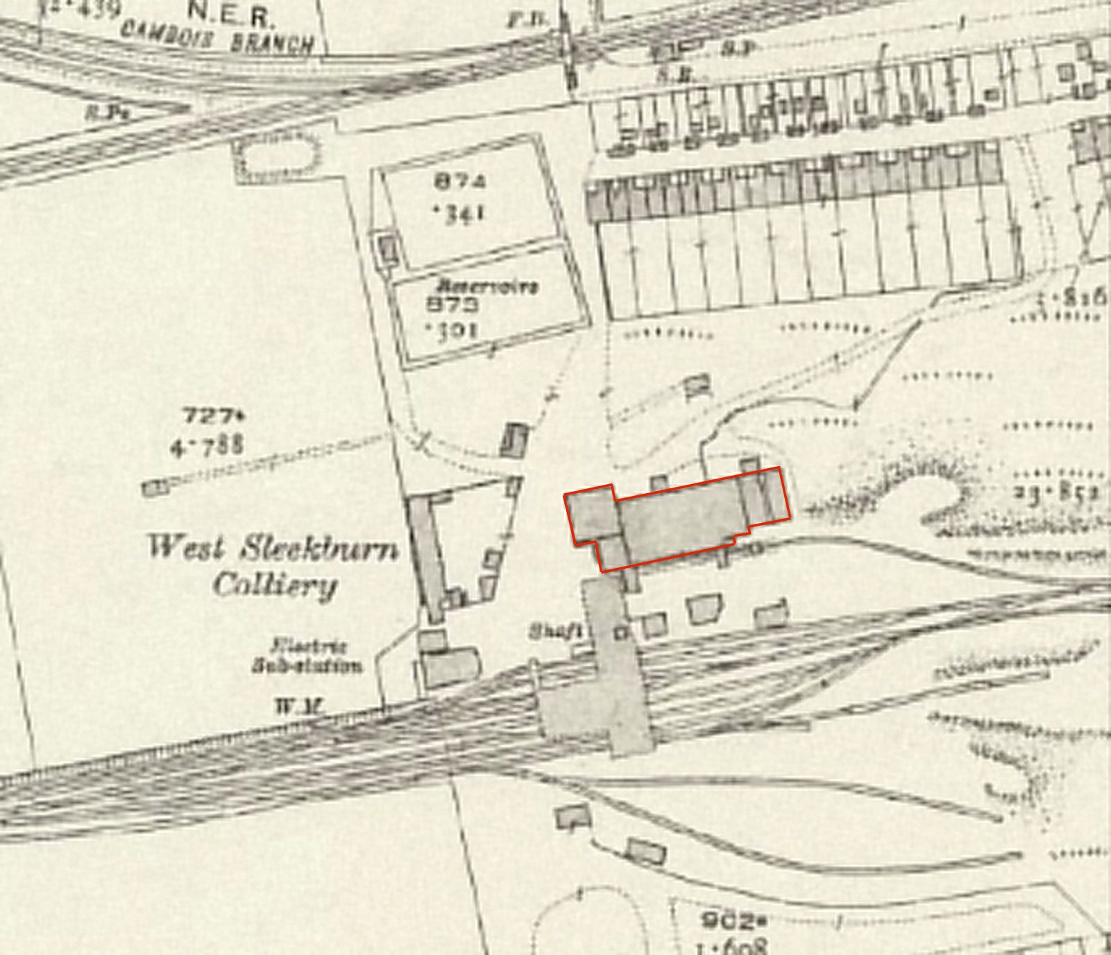
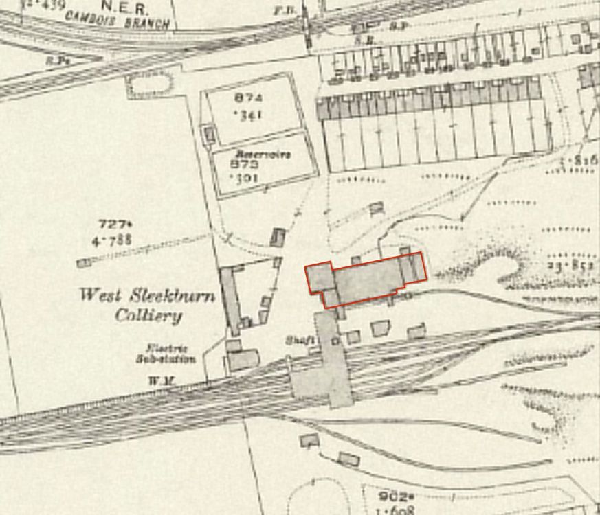
Hi High Pit Wilma, Thanks for that - I think you're right - looking at an old aerial photo of the colliery (although most of the building I'm interest in is hidden behind the headgear). The westernmost part of that building which was left onsite following the closure of the colliery was the winding house (almost identical to the one still standing at Earsdon - Fenwick Colliery), the boiler chimney behind that and other associated uses in the attached building behind including (as you stated) baths, equipment storage etc. - although the baths weren't opened until 1951. However, I'm more interested in what the use of this building was after the colliery closed (see attached with red outline of the building left after the closure of the colliery and which was demolished some time after 1977. This is now on the site of the first unit on your right when you enter the industrial estate (previously Elite Car Transport Ltd). This is the building which is shown as "works" on the earlier map. Cheers Gary
-
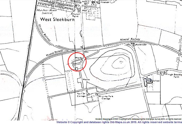
Hi, I'm looking to find out what the larger colliery building which was left after the closure of the colliery (1962) was used for. This building was the one which was approximately midway between the Cambois rail line to the north of the colliery and the internal colliery lines running from the West Sleekburn Junction to the shafts and screens then on to the soil heaps. On the 1977 Ordnance Survey maps this building is marked as "works" but by the mid-1980s / mid-1990s the building had been demolished. Please see attached map from 1977 - the building in question is ringed. Anything would be helpful - uses or company names...anything. Many thanks Gary