Richard Pyle
-
Posts
18 -
Joined
-
Last visited
-
Days Won
2
Content Type
Forums
Gallery
Events
Shop
News
Audio Archive
Timeline
Everything posted by Richard Pyle
-
That’s a very comprehensive answer. Thank you very much both of you! What do you think the attribution of the house to the early 19 century? Stylistically, I would say the right hand side of the house was more early to mid 18th century and the right hand side with the bow windows, late or very early 19 century. I also assumed that this was the house which in a 1757 sale advertisement for the ironworks which was described as a “commodious dwelling house, fit for a gentleman's family consisting of ten fine rooms, four of which are hung with genteel papers, with good cellars, a stable, large garden and other conveniences". Any thoughts?
-
I wonder what the house on the left was, Alan? It is surprising that they look so similar.
-
It is interesting that there are two separate buildings which look very similar in that both are next to Furnace Bridge and both are old buildings with a more modern extension that have bow windows. Dene House is the top photograph and is the building on the right in the third photograph. The other building is shown on the second photograph and is on the left in the third photograph and is the one shown on the fourth photograph. Dene House had four bow windows in total, the other building has only two. The third photograph shows that these were clearly two separate buildings and that the second and fourth photographs do not show Dene House. Another feature that distinguishes them is that the old part of Dene House had three stories whereas the old part of the other building only two.
-
That is a fantastic response. The internet at its best.
-
Hi everyone I have been looking into the history of the Hall but things seem to get even murkier the deeper I look. There is a big difference on the basic facts of the house between the newspaper article reposted by Alan Edgar on May 3rd and Evan Martin's book "Bedlingtonshire Remembered". When was the house built? The newspaper article says 1844, Evan Martin says 1824. (As it appears on the 1842 Tithe Map I am awarding this one to Evan Martin). Who built the house? The newspaper article says John Birkenshaw who later sold it to Michael Longridge. Evan Martin says Michael Longridge. When was it demolished? The newspaper article says c.1958. Evan Martin says 1949. As Ovalteeny remembers living there in the 1950's I am awarding this one to the newspaper article. Anyone with further information who can correct any of this for the record?
-
That's great. Now I know the name, I might be able to find out something more about it. Thank you for all your help.
-
That is very interesting. What is also strange is that on the identical site, the identical map is labelled 1962 on my computer and 1961 on yours!
-
That is great Alan. Thank you very much for your help!
-
Thanks!
-
It is from the old-maps.co.uk site and labeled 1984-1993 but I have found their dating to be a little unreliable sometimes. I hope that this helps!

-
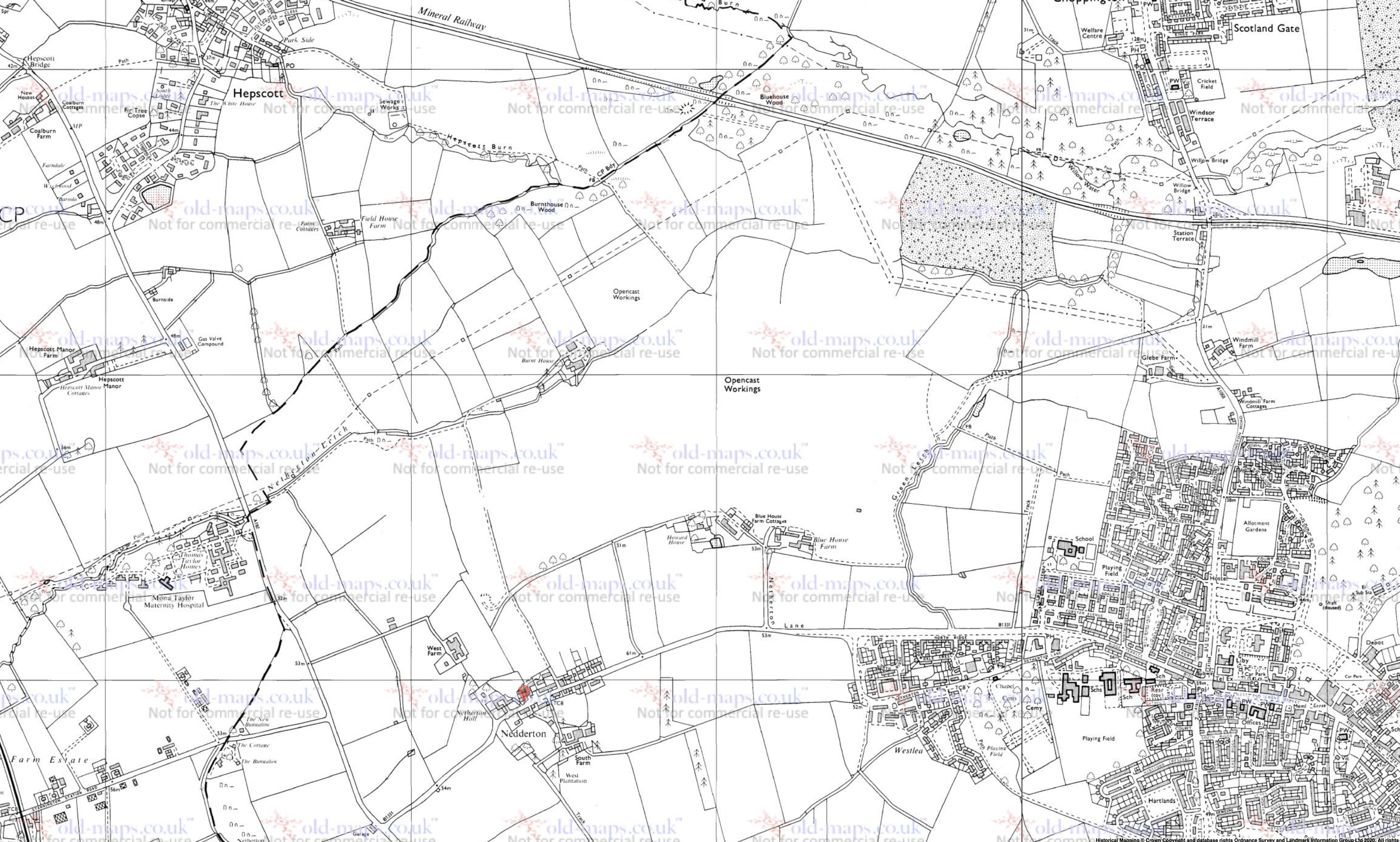
When going through the old maps of the Bedlington area I see there was a relatively small opencast mine where Netherton Colliery once stood. I cannot find any information about this at all online. My guess is that it was given some fancy rural name to distract attention away from it. It looks to have been in operation in the 1980's. Does anyone have any details about it? Does anyone know it's dates? Who operated it? Thanks for any help you can give. Richard.
-
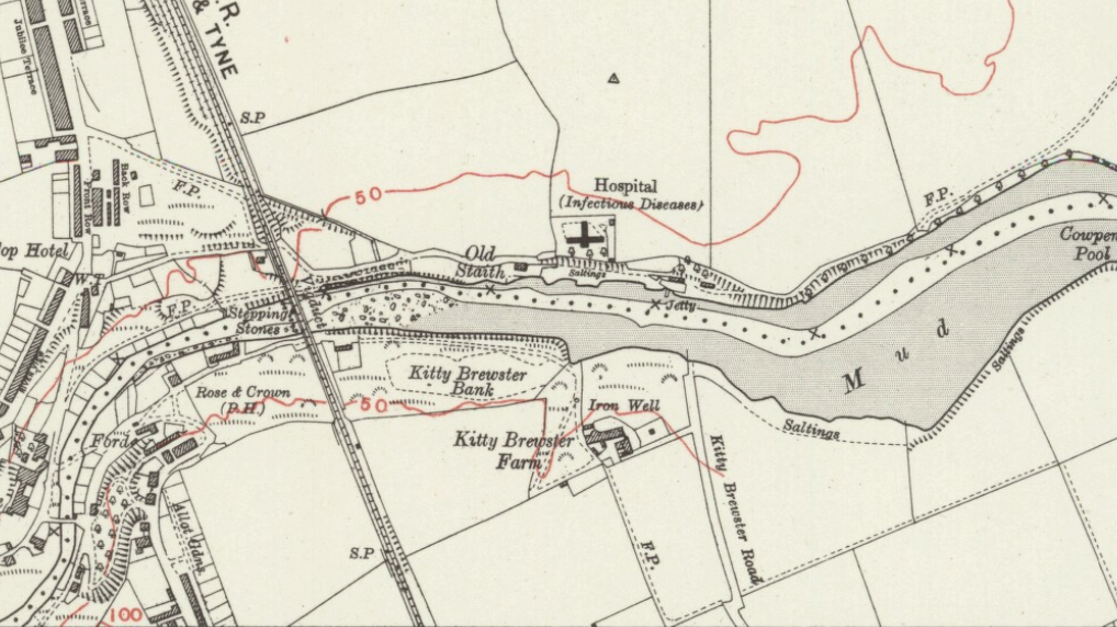
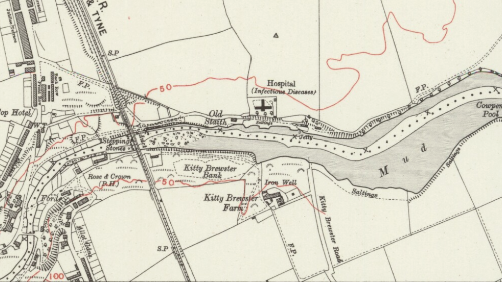
Does anyone know anything about the Iron Well marked on maps just next to Kitty Brewster Farm? Christopher Bergen's history of the Bedlington Iron Works mentions the well, when he describes how the ships exporting the iron would sail up the river at high tide and replenish their water from it. I am guessing that Its name derives from the iron taste of the water. The original iron ore for the first furnace at Bedlington was dug out of this field. Does anyone know anything more? Does it still exist? Does anyone have any photos of it? Thanks for your help. Richard
-
Thanks for your comment. I have not ruled out the idea of producing Android versions in the future. Currently it would be hard for me to ensure the quality on the different phones that run Android so I have decided just to run with iPhones. I take your point 'though and this may change with time.
-
Thanks for the information John. The app should be out in about a month's time. I won't be able to compete with you 'though, I only had four weeks to do my research for Choppington, not forty-four years! I only have one app out at the moment and that is for Cambois. You can get it on, https://itunes.apple.com/gb/app/cambois-village-guide/id649961567?mt=8 Newbiggin, Lynemouth, Ellington & Linton, North Seaton and Cresswell are all out in the next few days hopefully. I'm looking forward to you correcting any errors I might have included.
-
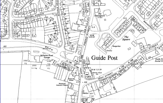
Queens Head and The Anvil Hi StuR and Johndawsonjune1955. About the debate on the location of the Queens Head and The Anvil in Guide Post. Your photomontage was very impressive and convincing StuR but if you look closely, they don't line up exactly. Look at the stonework around the windows. These are different in the old building to the new building and these are features that there would be no reason to change, even if the windows were replaced. Finally and more conclusively here is a copy of the ordnance survey map of 1962. The Queens Head is shown where the roundabout is now and the current Queens Head is shown as PH (Public House) presumably as Johndawsonjune1955 says The Anvil. It looks like when the old Queens Head was knocked down, the old Anvil pub took its name and that Johndawsonjune1955 is correct. I am researching this as part of an iPhone guide to the local history of Choppington, Scotland Gate and Guide Post I am bringing out in about four weeks time. If any of you are interested, you can get more information on this and other guides in the area on https://www.facebook...447428548681186
-
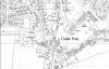
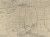
Hi everyone Thanks for replying so promptly. I'm sorry that I was a bit lax in getting back to you. I attach a photo of the farm and a map showing its location.

-
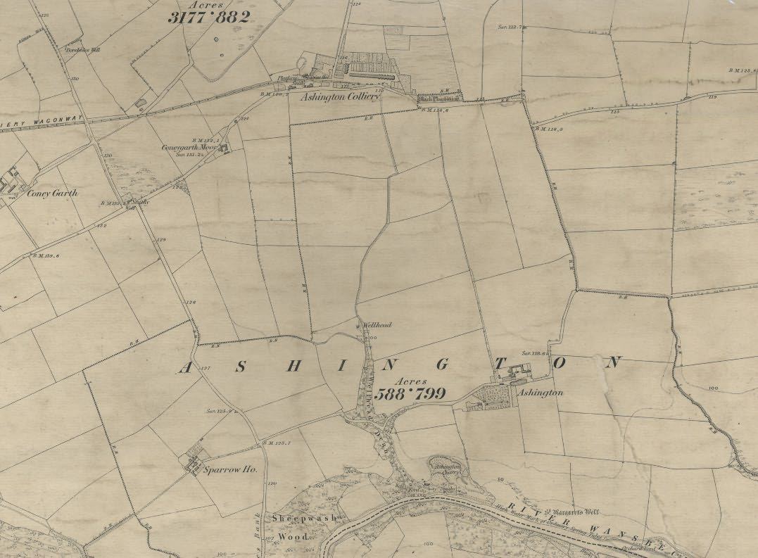
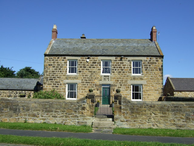
Hi I'm sorry that this is a little bit off topic, but hopefully it's not too far away. Does anyone know what the coat of arms above the door of Ashington Farm relates to? I am preparing a local history iphone app. for Ashington which the farm features in but I have been unable to discover anything about the coat of arms. I hope someone can help me. Regards Richard Pyle