


James
-
Posts
204 -
Joined
-
Last visited
-
Days Won
49
Content Type
Forums
Gallery
Events
Shop
News
Audio Archive
Timeline
Posts posted by James
-
-
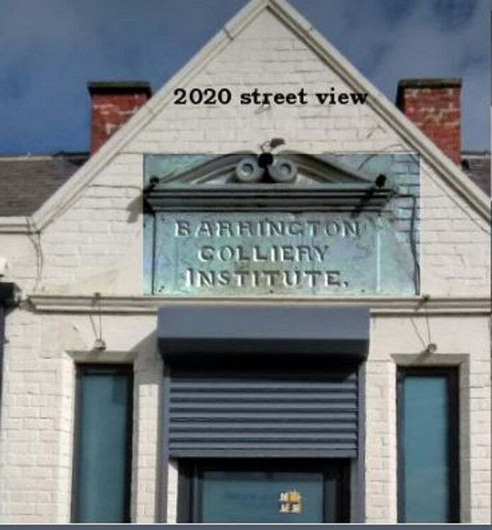
Barrington was a thriving community of around 800 residents not too long ago and its history is described in detail in Stephen Martin’s booklet “Barrington”. We are left with only one remaining record of the colliery and this is the inscribed tablet above the entrance to what was the Barrington Colliery Institute shown in the photo below.
I drove past the old institute recently and stopped to read the inscription and was disappointed to see the company using the property had placed their company’s logo over the inscribed tablet as can be seen in the second photo. The tablet was put there about 130 years ago and is a small but important part of the history of Barrington and could even be included in the Bedlington Heritage Trail. Perhaps the council should consider asking the company to remove the sign and repair any damages to the tablet caused when erecting the board.

-
 1
1
-
-
On 22/12/2022 at 19:57, Bill Harries said:
Met recently a chap "Bob Shadforth" in Morpeth Chantry tearoom,& coming from Bedlington.
Talked of coal mining of our youth!,Bob at "D" pit, me at Coneygarth drift,Ashington Colliery.
Mentioned a fella called James Fish,who was killed using Explosives,in the Sultanate of Oman in the 70's, & coming from Bed D pit earlier.
Could not believe it when Bob said he was Jim's marra at Doctor & later Netherton pit, before Jim went to the Sultanate.
This would be towards the end of the nasty conflict on the Oman,Yemani border in the Dhorfar mountains,with lots of dissident tribesman"wandering" around.
I myself just about replaced Jimmy in 1979,working blasting with explosives for a contractor to the shell/pdo oil company,from when I did 14 years in that land.
Such a coincidence that I meet Bob in the Chantry tearoom on Tuesday last,and with this 50+ year "connection.
I worked with both Bob Shadforth and Jim Fish.
Bob Shadforth worked at the Doctor Pit till it closed in 1968 and was (and still is) known as ‘Shafty’. His father also worked at the Doctor Pit.
There was a loading machine called a Sky – Hi Loader that was used on one of the longwall faces in the Plessey seam and Shafty was the operator of this machine. During my period of ‘face training’ I worked under Shafty, who instructed me in the use of the loader. We have met a few times over the years and he has often reminded me of the time when we worked together and he was my ‘supervising officer’
Jim Fish was a drilling operator in the Plessey Seam and this was one of the most physically demanding jobs imaginable in a 36 inch seam. I was in the Doctor Pit rescue team with Jim and the other member of the team was Sid Cole. We all completed a training course at the Ashington Mine Rescue Station. As mentioned, Jim was killed in a blasting accident in the 70’s. Sid Cole was transferred to Bedlington ‘A’ colliery (the ‘auld pit’) after the Doctor Pit closed and was sadly killed in a shaft incident 1970. The report at the Beamish mining museum states -
“He was killed while transporting girders from one level to another, the girders slipped and trapped him also getting the cage fast, a rescue attempt by his mate who climbed down the shaft using the guides and buntings was unsuccessful, and Mr. Jimmy Foster was awarded a medal for his attempt.”
-
 1
1
-
-
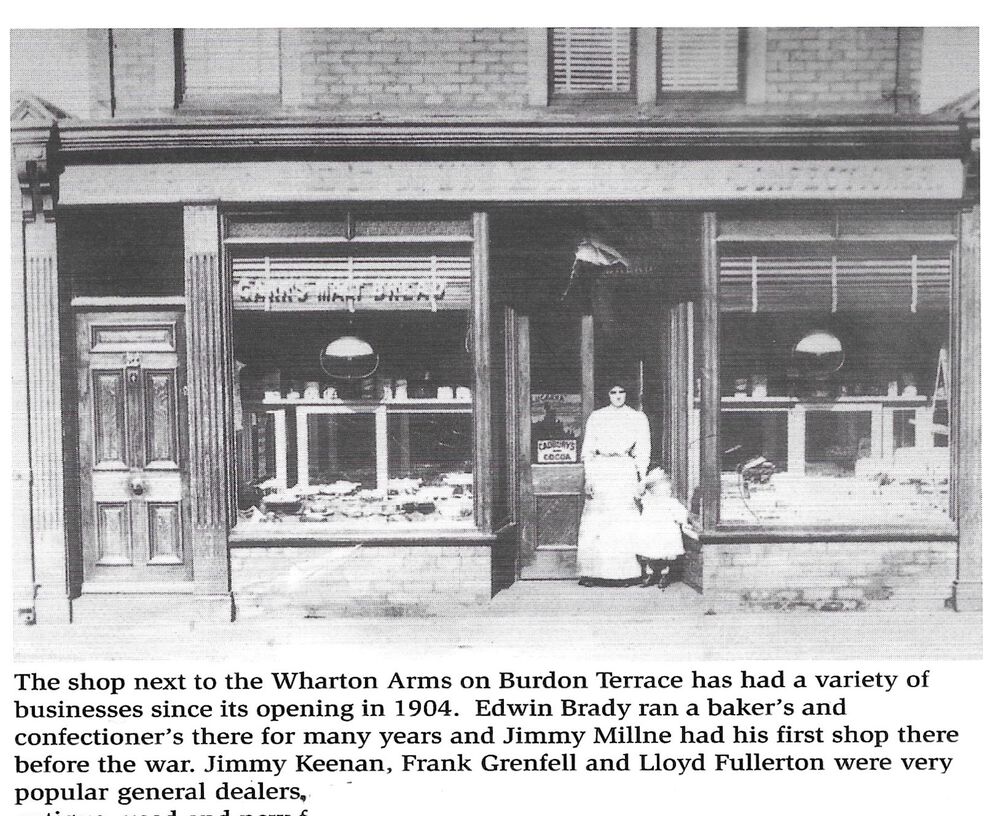
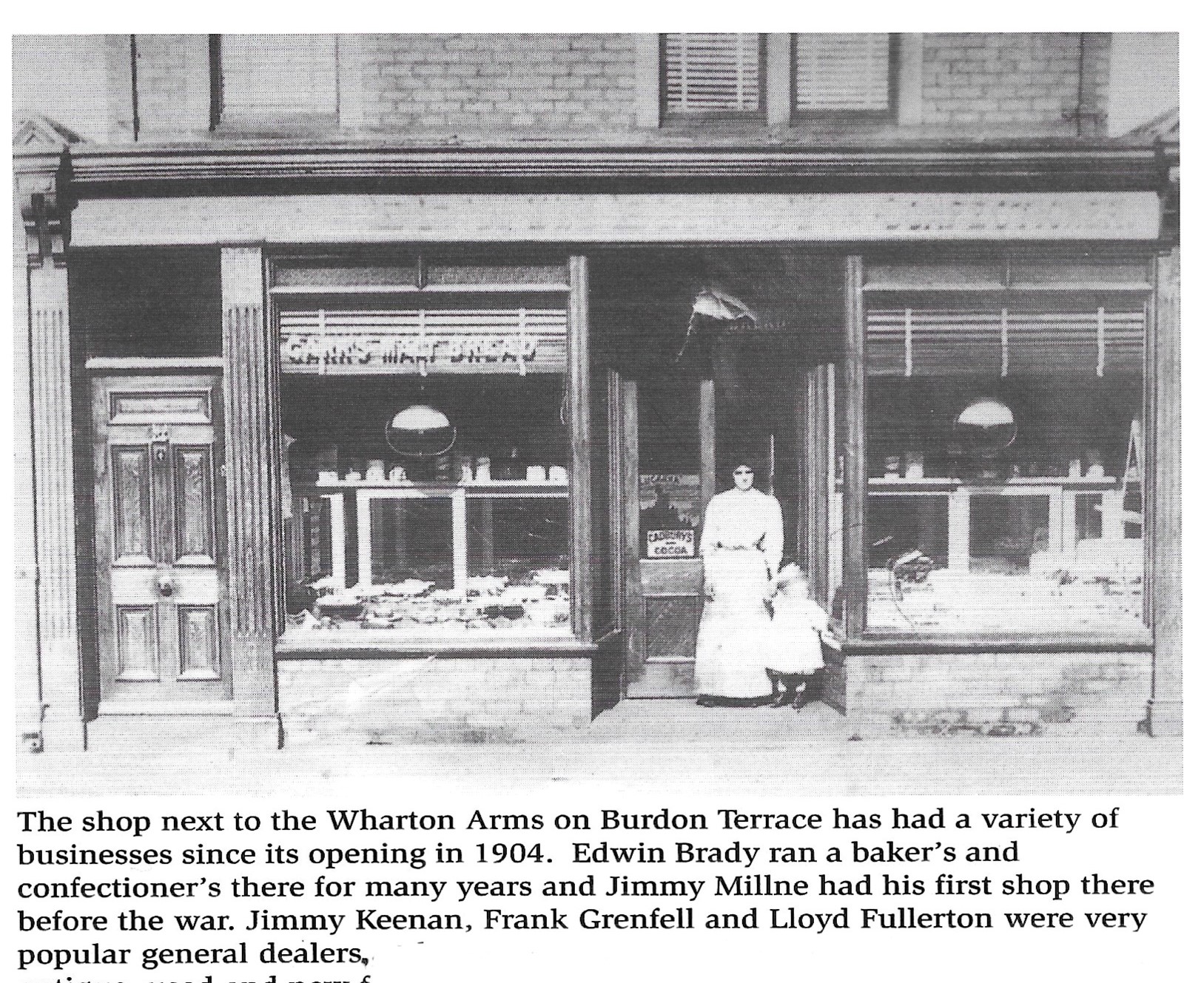
The photo is from Evan Martin's book "Bedlingtonshire Now And Then"
-
The attached photo is from one of Evan Martin's books with the names of some of the previous owners.
-
1
-
-
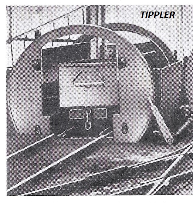
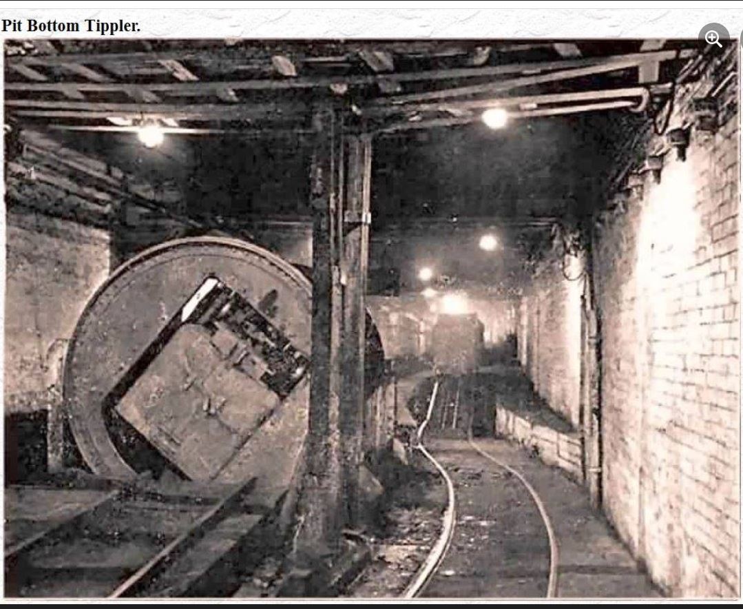
10 hours ago, HIGH PIT WILMA said:
Aam studying this Tippler at thi pit bottom pic,and aam puzzled as hell!!
Why wud ye want ti tip mine cars oot underground?..they were just filled an hour before reaching the shaft bottom!..even if there was a drift conveyor to the surface like Lynemouth...why would they use mine cars being filled and tipped? beats me!
Bates Colliery was completely reorganised after nationalisation in 1947. This is described in the following link:
http://www.dmm.org.uk/colleng/5910-01.htm
The massive reorganisation was carried out without any loss in production and this required temporary coal handling arrangements and one of these was to have, for a short time an underground tippler. The following paragraph is taken directly from the article in the link.
“No. 3 shaft pit-bottom has been completed, but until a new heapstead is built it will not be suitable for coal winding, consequently the 3½-ton minecars are tipped in the pit-bottom and the coal is reloaded by conveyor into tubs for winding up Bates shaft.”
p.s. There is also a "creeeper" in the photo - it is at the end of the rails at the right of the photo.

-
2
-
-
On 09/05/2022 at 22:49, HIGH PIT WILMA said:
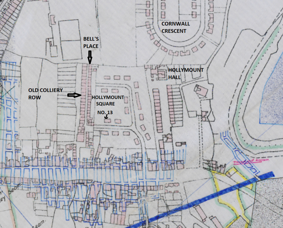
when my Parents moved into Hollymount..[herinafter referred to by me as "Hollymoont"!] Square,around the 1947/8 period in time,only half of the square was built..oddly enough,they weren't built in numerical order!
The plan I have attached is part of an underground plan of the Doctor Pit Low Seam workings so I know you will understand it. The blue markings are underground pillars and the thick blue line is an igneous dyke.
You say you moved into no 13 Hollymount Square around 1947 when it was only half built.
Some underground plans had to show certain surface features and by pure chance, the buildings on this this plan were added when Hollymount Square was only half built so it shows half of Hollymount Square as well as Bells Place and Old Colliery Row. Shortly after this plan was drawn up, the old rows were demolished, the site cleared and the other half of Hollymount Square was built.
What is surprising is that the main underground plan shows that the Low Seam workings under Hollymount Square were mined from the ‘Auld Pit’ (Bedlington ‘A’) not as you would expect, from the Doctor Pit.
-
1
-
-
On 07/09/2022 at 21:37, Canny lass said:
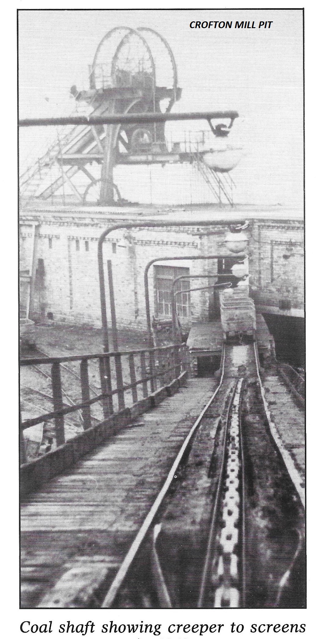
I'm very pleased to hear it!! You can further my mining education here by explaining what "tipplers" and creepers" are.
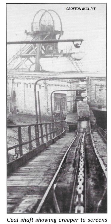
Photos showing ‘creeper’ and ‘tippler’ attached.
The photo of the ‘creeper’ was taken at Crofton Mill colliery that was in Blyth
The ‘creeper’ was an endlessly circulating chain driven by a motor that conveyed tubs from one level to a higher level. In the photo the chain is in the middle of the tub rails and had steel hooks spaced throughout the chain that would hook onto the axle on the underside of the tub and raise the full tubs to the tipplers. The full tub would then be pushed into a tippler that emptied the coal out of the tub onto the screens.
The ‘tippler’, as the word suggests, tips the coal out of the tub. The full tub would be placed in the tippler and by pulling on the handle, the tippler would rotate 360°. At the Doctor Pit, the empty tub then ran down to the ‘creeper’ that raised the tub to the cage level ready to be sent back underground.
-
1
-
1
-
-
Sorry - It should read 'the 6 townships website no longer exists'
-
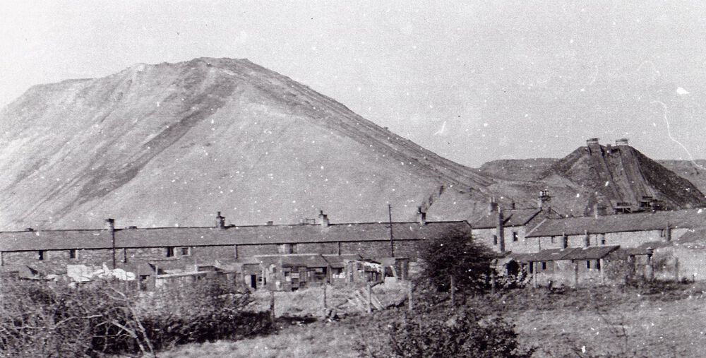
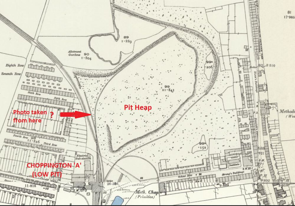
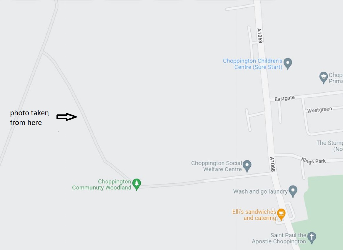
I cannot remember anything about The Low Pit (Choppington ‘A’) other than the pit heap that could be seen from miles around. I have attached a better photo of the pit heap and on the plan I have indicated where I think it was taken. I believe it was from behind North Front Row with Fourth Row on the right. The pit headgear is just out of sight to the right of the photo.

-
1
-
-
Hi John
The 6 townships website is no exists. This sounds like a great DVD and I was wondering if it is still available. It would be greatly appreciated if If anyone knows how to obtain this video
-
23 hours ago, PaulJ said:
Hi all,
Thanks to all for the info. Like you I use the maps from the National Library of Scotland. They are good for seeing what was around the area way back. It helped to explain why I was seeing “Red Row” in census reports for Bedlington area when I was following family history as my GG grandfather was living in Bedlington after his family moved up from Norfolk in the 1850’s.
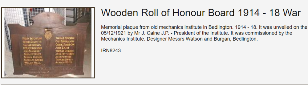
The info about the origins of the Institutes is really interesting. I was looking for information on the Honour Roll as my wife’s GG uncles are named on it.
Were any of your wife's relatives on the Roll of Honour?
.png.6771405b903bbe716d682dc88b309dc5.png)
-
1
-
-
Canny Lass
You are getting mixed up with the two different Mechanics Institutes.
Evan Matin's book is about the Ironworks Mechanics Institute.
The 38th anniversary refers to the Colliery Mechanics Institute.
-
Canny Lass
The Bedlington Iron and Engine works operated between 1736 and 1867 and The Doctor Pit operated between 1855 and 1968. Each had their own Mechanics Institute.
The Ironworks Mechanics Institute was in the Clock House at Furnace Bank and was opened in 1829 (from Evan Martin’s book on the Ironworks.)
The Colliery Mechanics Institute was initially at the Market Place and then moved to what is now the community centre. I don’t know when it opened but it is shown on the 1860 map of Bedlington so it must have been shortly after the colliery started operating
-
1
-
-
Eggy
It was never known as the Top End Mechanics Institute. It was the Colliery Mechanics Institute, referred to by everyone as “The Chute.” Your map shows its location after it moved from the Market Place. The 1860 map I have attached shows it when it was in the Market Place. We were told that it was situated in the building that later became Peter Bacci’s shop (there was a billiard room at the back of his shop with two billiard tables.) but I have no proof of this although the map indicates that this is where it was sited. You have posted an 1896 map and mine is dated 1860 so it must have moved between those dates.
-
1
-
-
Symptoms
The full name of the institute was the Bedlington Colliery Mechanics Institute. It was first located in the Market Place (Peter Bacci’s shop) then moved to what is now the community centre. This was the only colliery institute in Bedlington. The other colliery institutes were at Netherton Colliery, Bedlington station, and Barrington (the Glove Factory)
-
1
-
-
On 24/04/2022 at 16:31, PaulJ said:
Hi,
Doing some research on family history and the topic of the "Scroll of Honour" from WW1 came. Apparently it was displayed in the Institute so does anyone know where it is now?
I believe it is at the Beamish museum.
-
2
-
-
The photo is from Evan Martin's book 'Bedlingtonshire Now and Then'
-
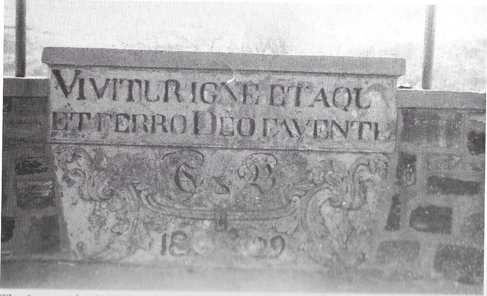
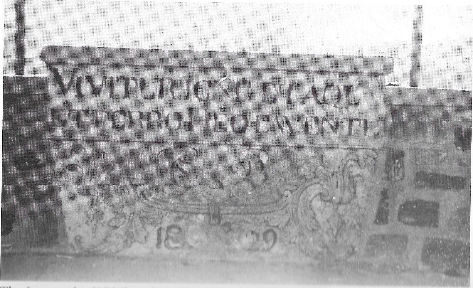
Evan Martin, in his book on the Ironworks states the bandstand was built in 1959 when the buildings around furnace bank were demolished, the site cleared and Dene Park formed. The stone from the institute engraved with the works motto ‘Vivitur Igne et Aqua et Ferro Deo Favente (‘We Live by Fire, Water, Iron and the Grace of God’) was set into the newly built bandstand and this can be seen in the photo. The bandstand was demolished in the 1970’s.
At around the same time a bandstand was built near Spring View at the bottom end of Bedlington. The Salvation Army band and local Colliery bands used to give concerts at these two bandstands and they were quite popular for a while then along came TV and people lost interest in that sort of entertainment.
-
1
-
-
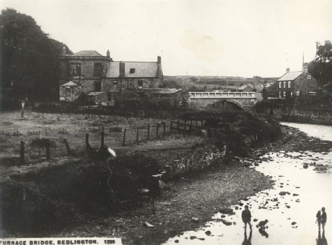
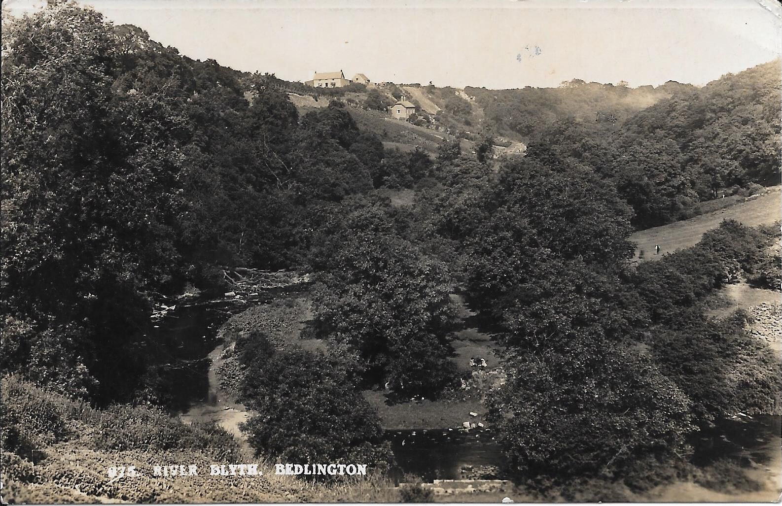
The photos show the area you refer to. The river at this point was tidal so it was a bit deeper at high tide. You had to keep clear of a raw sewage outfall on the Bedlington side of the river!

-
1
-
-
On 19/02/2022 at 14:26, Alan Edgar (Eggy1948) said:
Can't remember one. All I remember is that we always referred to it as the path on the Ha'penny side.
I can't even remember me ever venturing very far along the path on the Ha'penny side. My memory says - narrow track and heavily wooded. I must have obeyed me mam - divn't get lost, stick to black path

In the 1950's, below Beatty Road there was a bathing area in the river called “The Flaggies” where the river was deepened by damming the water with rocks. The clearing in the woods where everyone would gather was on the Ha’penny Woods side of the river and in the summer during school holidays and weekends a fire would usually be lit and kids would hang around all day until occasionally someone’s mother would call out across the river telling us it was getting late and time to go home. There was a similar bathing area half way along the Piper Woods called the ‘Big Bather’ and this was mainly used by kids from Millfield and the bottom end of Bedlington. The Piper Woods are the woods between Bedlington Bridge and Humford on the Blyth side of the river that are no longer open to the public.
-
1
-
-
19 hours ago, Alan Edgar (Eggy1948) said:
As the photo, top right, has the gentleman standing on the Free side of the woods the two photos along the bottom could also be from the Free side but they are not what I remember from the buildings that were next to the 'Black Path' that led from the entrance to the Free Woods from the Furnace Bridge up to Beatty Road where me granny lived and we often went to her house via the Black Path. I can only remember one cottage that was close to the Black Path, probably half way between Furnace end and Beatty Road end
Heather’s photos are great – is it possible she could have them properly scanned? I cannot work out where the last 2 were taken. I can remember two cottages down the black path and walking from Beatty Road down to the furnace bank, the first one was on the right hand side of the road and the second on the left hand side. Probably the first of these cottages is the one in the photo that was taken from Bedlington bank with the Ha’Penny woods on the right. The photo was taken before Beatty Road was built and the farm house at the top is Mill Bank.
-
6 hours ago, Alan Edgar (Eggy1948) said:
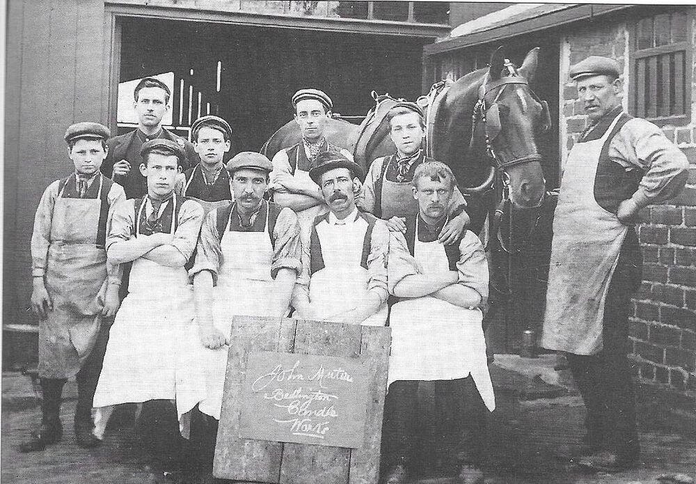
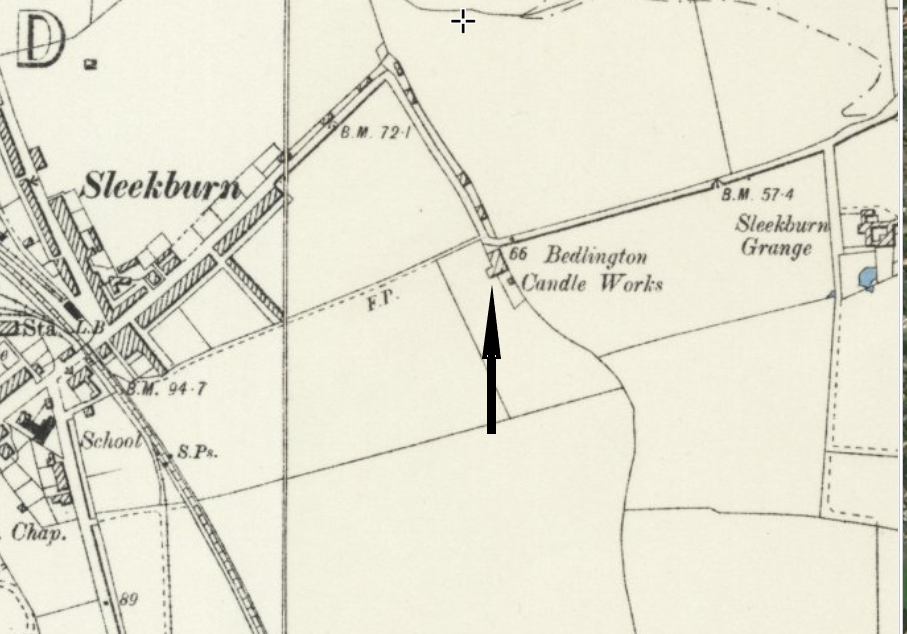
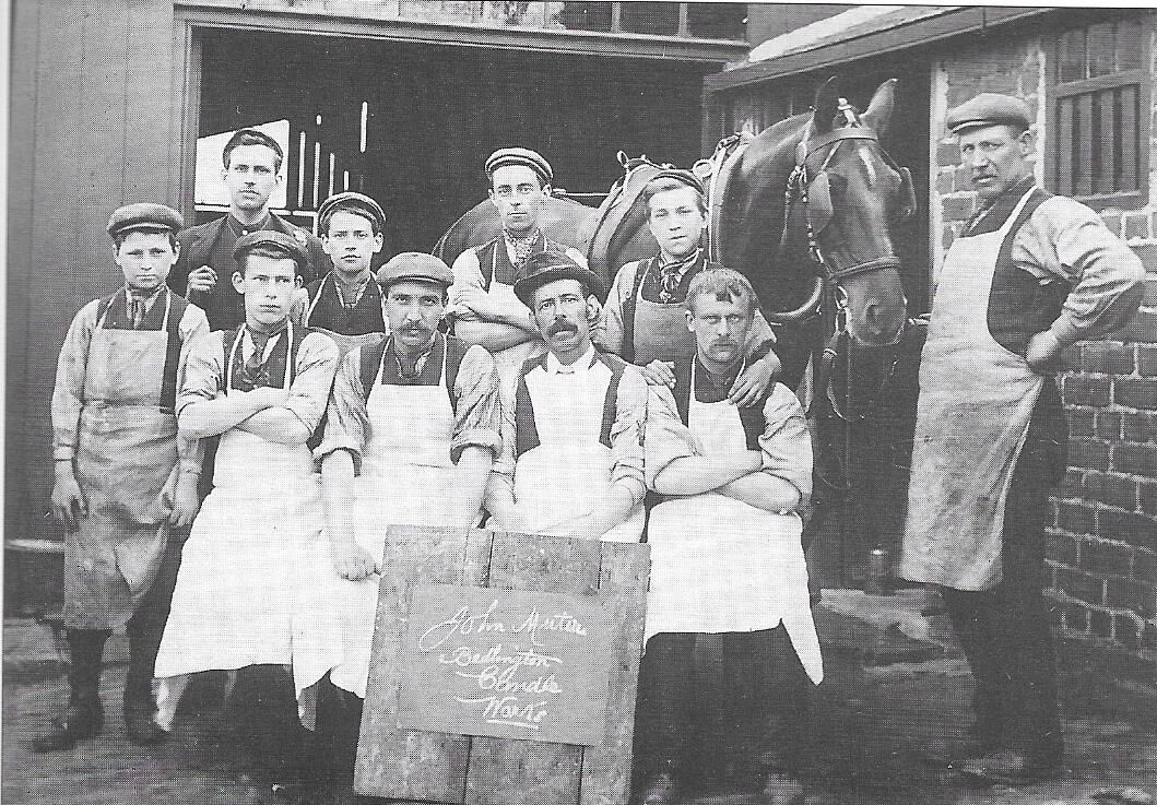
It also shows there was another candle factory - Bedlington Candle Works.
The other candle factory was Muter’s candle works and was situated at the bottom of St Johns Road where it meets the Stakeford Road. (Cross roads with traffic lights.) Across the road is Moorland Avenue on the way to Cambois. The photo is from another one of Evan Martin’s books.
-
1
-
-
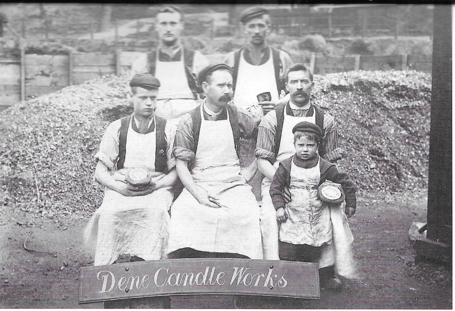
16 hours ago, Jo C said:
My Grandpa Thomas Bestford, and 4 of his brothers fought in WW1, 2 of them lost their lives.
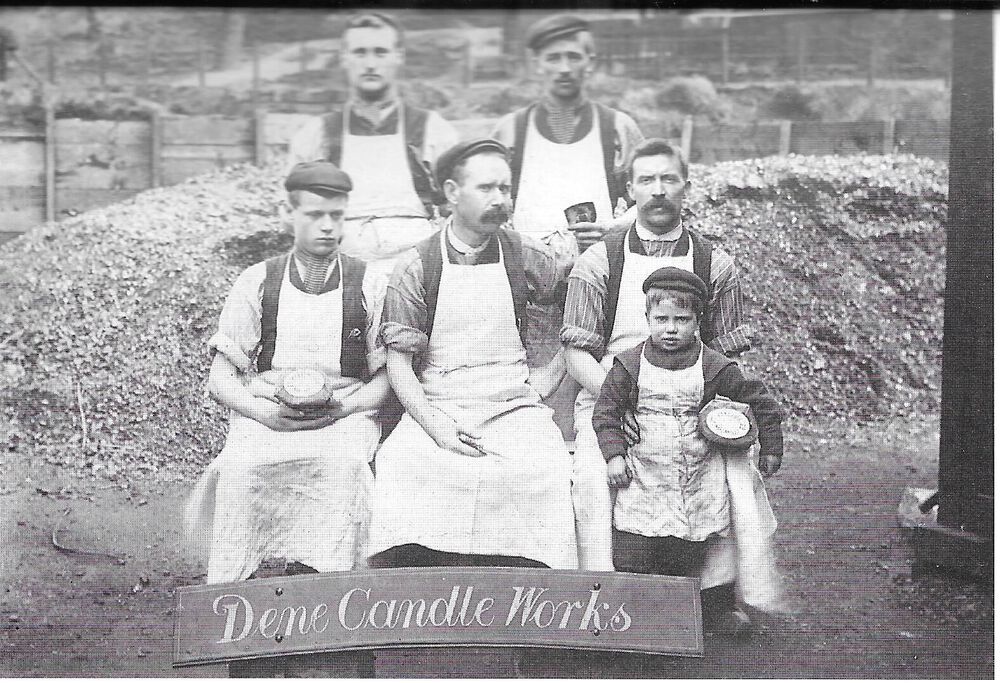
The 1901 census shows that Thomas Bestford lived at the Ironworks and was a candle maker so he must have worked at the Dene Candle Works, at the bottom of furnace bank. The photo, taken 1908 is from one of Evan Martin’s books.
-
3 hours ago, Canny lass said:
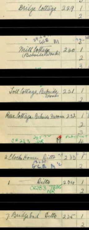
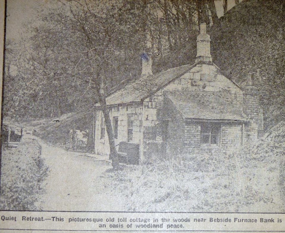
Unfortunately, I have not been able to find Toll Cottage recorded by this name in any public record
It is recorded as Toll Cottage in the 1939 census and called toll cottage in the newspaper cutting.

-
1
-

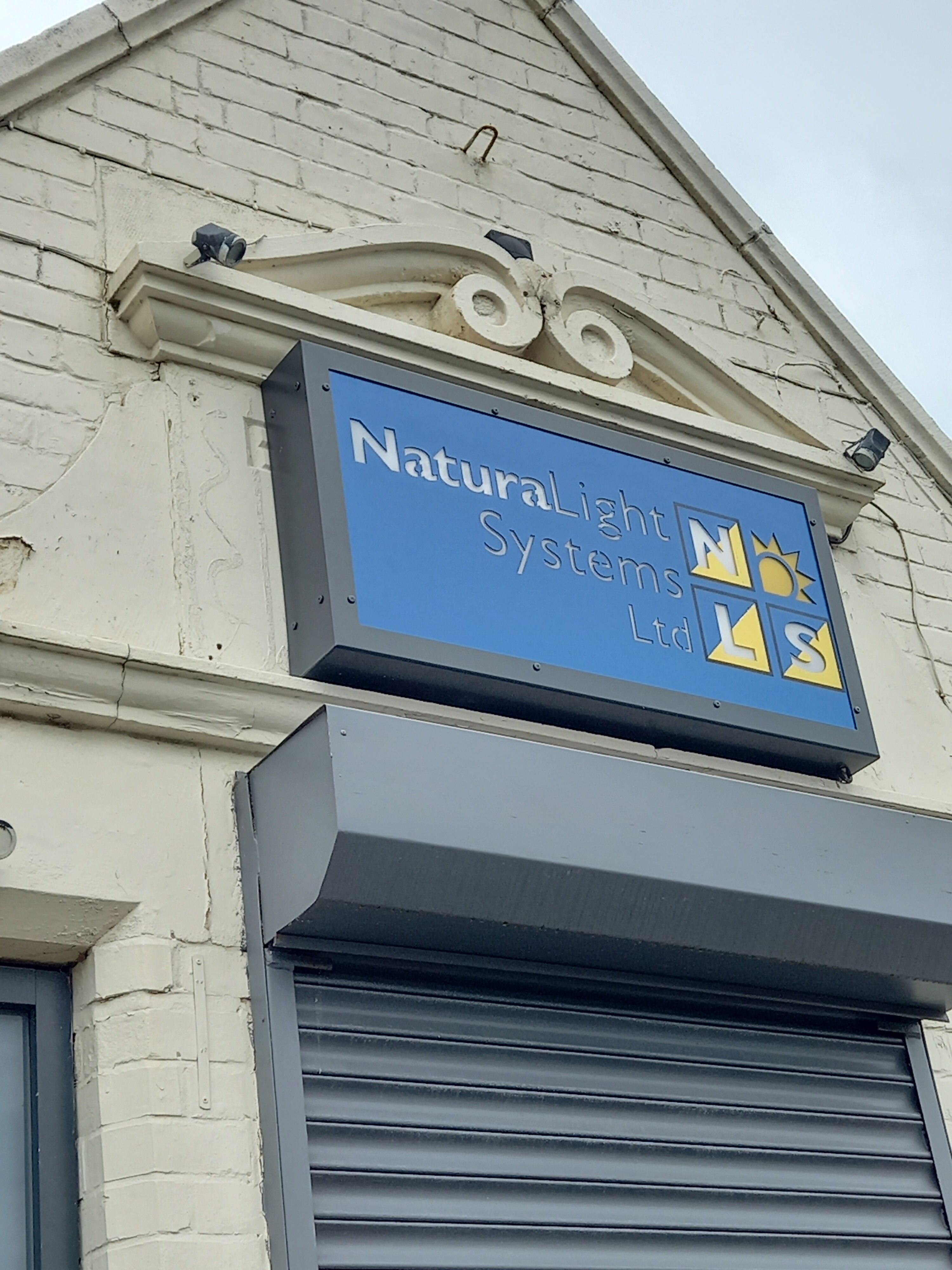


Front street east building
in History Hollow
Posted
Very few changes have been made to the building. In the photo, taken early 1900's, the Gibson family property is the first building on the left.