
Contributor Leaderboard
.thumb.jpg.7493ddab4a696108cf2b849323d3c155.jpg)

Popular Content
Showing content with the highest reputation on 23/01/22 in all areas
-
I've just come across this interesting site created by Derek Johnstone about those local lads who died fighting in the Great War (I don't know if this has been posted on this forum before). https://docplayer.net/152715054-Bedlington-soldiers-who-died-in-the-great-war.html1 point
-
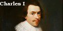
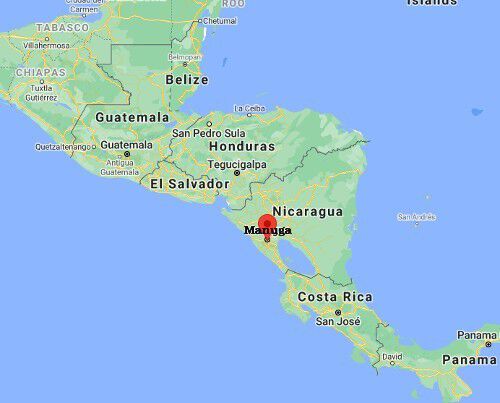
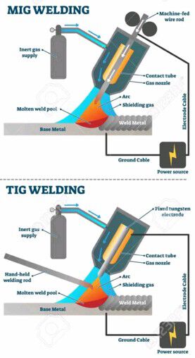
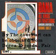
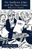
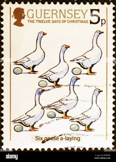
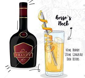
1. Where in London did an IRA bus-bomb occur in February 1996? Answer = Aldwych 2. Who was the King of England, Scotland and Ireland from 1625 to 1649? Answer = 3. Who is the patron saint of carpenters? Answer = 4. What is the capital of Nicaragua? Answer = 5. What would your occupation be if your work involved you with MIG and TIG? Answer = 6. Which sportsman was nicknamed ‘Guy the Gorilla’? Answer = 7. Who composed the Pathetique symphony? Answer = 8. Which spirit forms the base of a ‘Horse’s Neck? Answer = 9. How many arms bearing suckers does a squid have? Answer = 6 10. Who had a number one hit with All Kinds of Everything? Answer = 11. Which British PM resigned over the Suez crisis? Answer = 12. How many geese were “a laying” in the Christmas song? Answer = I’ll bet you didn’t know …. Benjamin Disraeli’s false teeth once fell out whilst making a speech in the House of Commons Answer = I didn’t. But I know mine did ☹️


 1 point
 -
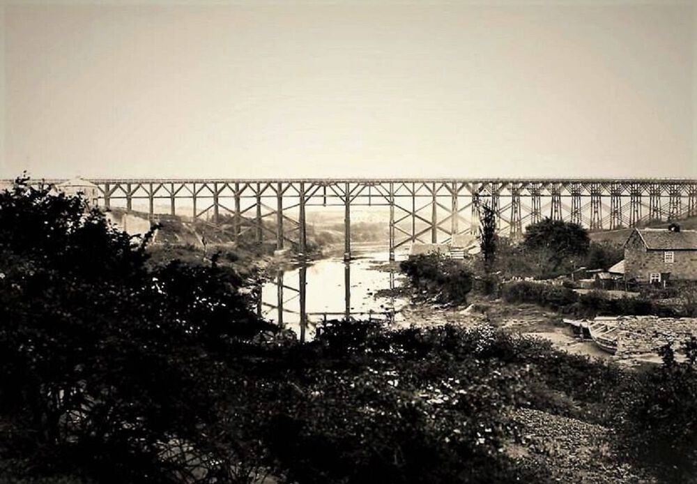
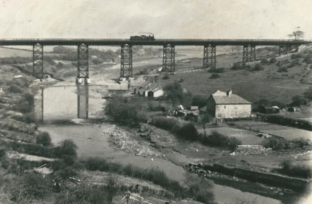
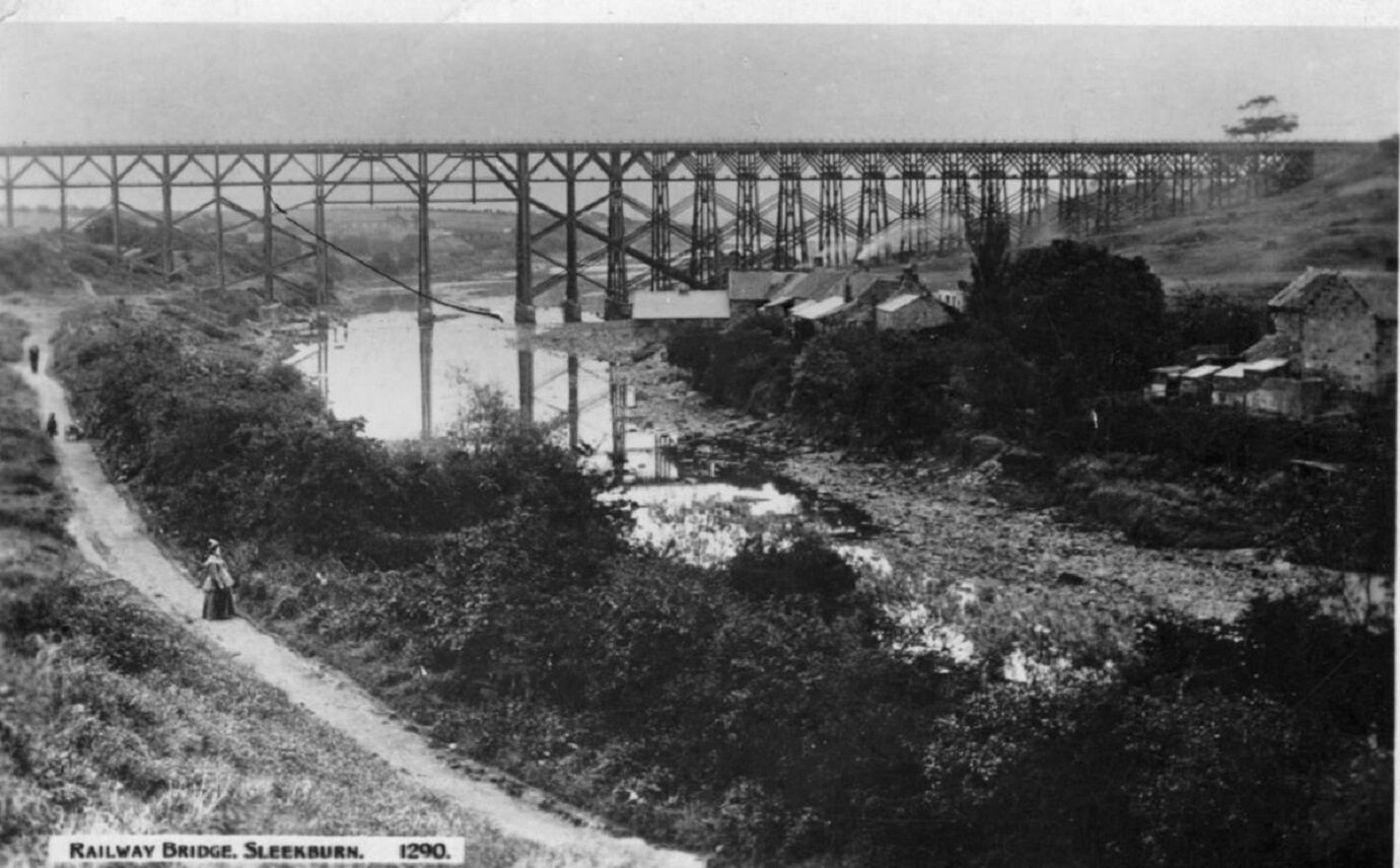
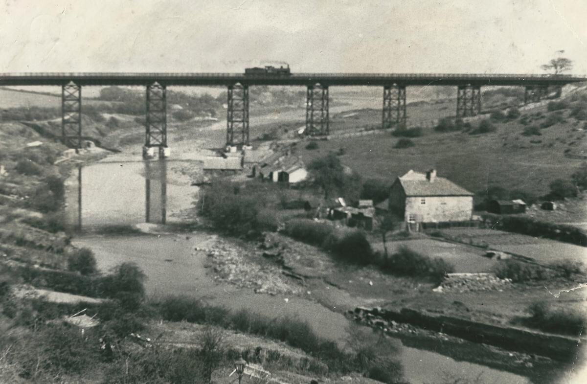
Two earlier photos of the Rose & Crown showing the wooden bridge. The Bedlington Coal Company built the first Bedlington Viaduct in June 1850 as part of its line from Newsham to Bedlington. It was a timber trestle bridge designed by Robert Nicholson, 80 feet high and 770 feet long. (From article “Bridges on the Blyth”) In 1930 the old wooden structure was demolished by the London and North Eastern Railway and was replaced by the present iron bridge (The Black Bridge). (From article “Bridges on the Blyth”)
 1 point
 -
Hi Alan (Eggy) Thank you. I actually had that one of the Rose & Crown, although it is nice image, it shows very little of the actual building concentrating more on the man . Very much appreciate the heads up on the others though and getting back to me. Hi Canny lass Thank you you very much for the maps and photo's it helps a lot with positioning etc.. So from your description I would assume the closest building to the viaduct is the Rose & Crown. It is lovely to be welcomed on to the page and to be given so much information. It is very much appreciated. Bedlington and Horton play a major roll in my families history and its journey into Iron and Steel. I look forward to talking to all more in the the future Kind regards Brian1 point
-
I knew I had one somewhere! The larger building to the right of Viaduct Cottages (sorry, I said Keelmans Row earlier. That was a mistake)
 1 point
 -
@MichaelDavidson - Have you ever looked at the info on the Durham Mining Museum (DMM) site? The site is ran by a charity and I believe all those that help on the site are volunteers. The site has info on all Northumberland and Durham collieries and included in the info on the 2 Bedlington collieries - 'A' & 'D' pits - are the list of owners from 1850 that you have mentioned above and then the owners from 1950 until their close = 1860s - Bedlington Coal Co. 1890s - Bedlington Coal Co. Ltd. 1947 - National Coal Board (N.C.B.) This is a direct link to the Bedlington colliery page on the DM site :- http://www.dmm.org.uk/colliery/b022.htm1 point
-
@Bhx7 - have you checked back through page one of this topic? There is an image of the Rose & Crown pub. The image is showing a local Man, Matty Whinthrip, with his Horse and Cart outside the pub. The photo is from a book by local historian's Stephen B. & Evan Martin. Also on page 1 of this topic there are a couple of photos showing the wooden bridge and the steel bridge that replaced it. There are buildings in each photo and one of them must be the Rose & Crown. Hope that helps.1 point
-
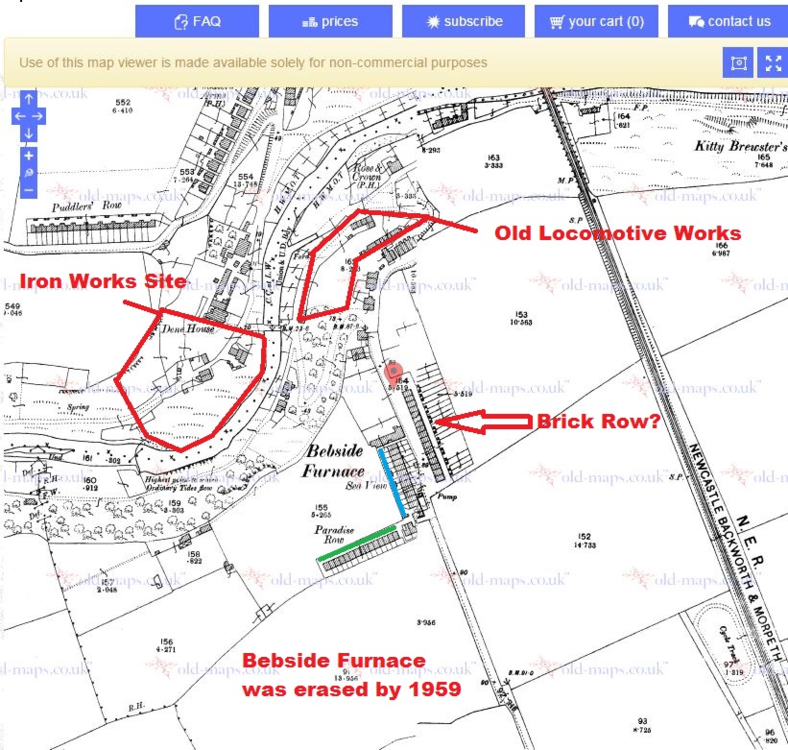
Welcome to the forum, Bhx7! You are correct. The Rose & Crown Inn was located to the west of the viaduct and situated between Keelmans Row and Rose & Crown Row. (Ignore the red star) Census enumerators were creatures of habit who followed a strict route. In the 1901 census, having left the Sea View/Paradise Row area (Bottom right corner of map) he entered the Iron Works area and followed his route including Fergusons Row (where my father was born, 1900) proceding through Old Factory Yard and its offices, he then makes his way downhill to the riverside where he records in the following order as he walks towards the bridge at the foot of the hairpin bend: Green – Rose & Crown Inn (marked P.H. ’Public House’ on the map) Orange – Rose & Crown Row (nrs 1-6) Pink – Bridge House Yellow – Clock House Blue – Rose Cottage, the last dwelling in his district (Cowpen 16)' The Rose & Crown Inn is actually named on this second map from 1897 just 4 years before the census. Thanks to Eggy for the art-work on this last map. As you see, he's much better at it than I am!
_LI.thumb.jpg.4bb2b4f2a23e1e1df9c0b63d6f01c83f.jpg)
 1 point


_LI.jpg.4856a3ca8c59602237c05eb81410bbcb.jpg)
